Introducing Cairo's first Public Transportation Map
Introducing Cairo's first Public Transportation Map
Transport for Cairo maps formal and informal transport transit networks, providing raw data, enabling trip-planning and working on improving the system. The data is made available in GIS shape files or GTFS transit feeds. To learn more about the contents of the data, please download the Data factsheet.
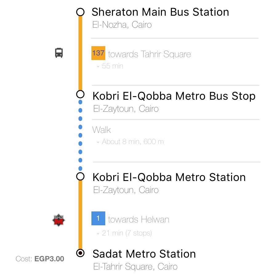
Explore the routes and stops of the public transport network of Cairo using Egypt’s most complete geographic information system.
Build trip-planning apps, data visualizations and awesome models using the only GTFS feed for public transit in Cairo.