Introducing Cairo's first Public Transportation Map
Introducing Cairo's first Public Transportation Map
Build trip-planning apps, data visualizations and awesome models using the only GTFS feed for Cairo.
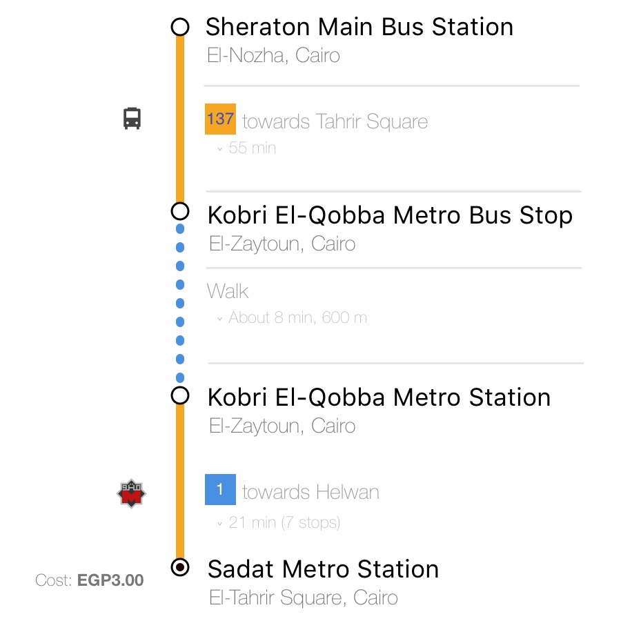
GTFS (General Transit Feed Specifications) feeds enable the accurate planning of any trip around Cairo using a combination of the underground subway system (Metro), the public CTA buses, the minibuses, and the iconic microbuses. The advantage of using an automated trip planner instead of the current system of word of mouth is efficiency and economy. New and old public transit users alike will benefit from checking their routes before embarking on their journeys. The system will automatically generate different alternatives that may help people save money, time, or even both. Our current model also acquires Google Traffic information in order to calculate expected delays and provide estimated times of arrival.
As part of our commitment to Open Data, we are happy to share the output GTFS feed to be used under a non-commercial license. The hope is that interested hackers can glean ever more exciting insights from the data that is publicly available on the streets of Cairo, and enable en eco-system of trip-planners to serve end-users. To download the latest GTFS feeds on public transit in Cairo visit our Github.
The data is published under a Creative Commons CC BY-NC license. For proper attribution, please add the following text “This data was created by Transport for Cairo ’TfC’ with DigitalMatatus and Takween for Integrated Community Development, under the Digital Cairo Project supported by ExpoLive 2020.”
For transport professionals looking for a more detailed data and professional software developers looking to build commercial applications, we offer access to the more advanced and complete GTFS feeds and licensing of the data for commercial use. Additional information include more accurate and detailed estimated schedules, pricing information, transfers and other; as well as dedicated support by our transport consultant and engineering teams. A number of local and international journey-planners have already used the GTFS feeds. Please contact us.

A GTFS feed is composed of a series of text files collected in a ZIP file. Each file models a particular aspect of transit information: stops, routes, trips, and other schedule data. The details of each file are defined in the GTFS reference. Many types of applications consume GTFS data, including apps for Trip planning and maps, Timetable creation, Accessibility Analysis, Planning & analysis and Real-time transit information applications. For more info, GTFS.org provides an excellent starting point.
No. Any application or use of the GTFS feed that generates revenue through payment, ads or any other form of direct or indirect monetization is prohibited by the Creative Commons CC BY-NC license which the GTFS feed uses. Please contact us to discuss the option of licensing the data.
Of course you can. However, the software must be for a non-profit purpose, be shared under Creative Commons CC BY-NC license or other open source software license and properly attribute the data. We encourage you to build apps to learn more about GTFS, explore public transit in Cairo and help commuters reach their destinations.
Please feel free to contact us with your question. Please type ‘QUESTION’ in the e-mail subject.